Pan Gulf Technologies Engineering Services
Scan to 3D - Oil & Gas
Get to know more about the project below
Scan to 3D - Oil & Gas Plant Project Overview:
Pan Gulf Technologies collaborated with a leading global oil & gas company to execute a large-scale asset digitalization program across a 320-acre integrated production facility. Leveraging extensive experience in engineering support for complex industrial operations, our team transformed legacy engineering infrastructure into a digitally integrated, asset-centric environment by integrating more than 1,200 P&IDs data across 18 major process and utility areas.
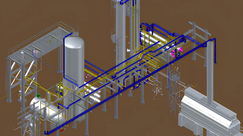
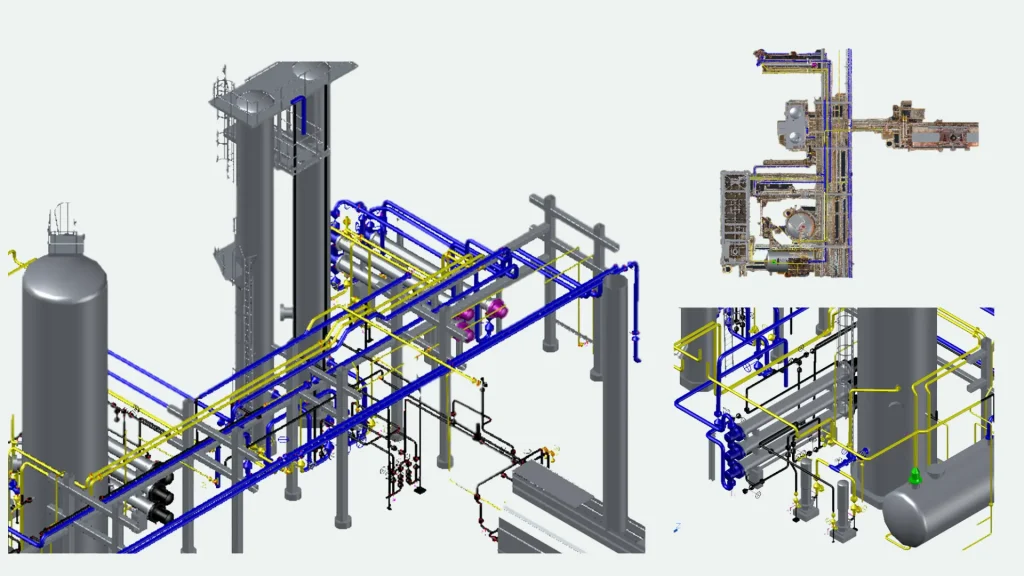
As part of the initiative, PGT developed a comprehensive database for 3D Mapping of Industrial Piping Infrastructures by integrating field-verified 3D laser scan data with intelligent engineering information. This enabled accurate spatial mapping of piping systems and assets, improving visualization, asset traceability, and engineering accuracy for brownfield and revamp projects.
The integrated digital framework significantly reduced dependency on fragmented legacy documentation and minimized manual field verification efforts during engineering and maintenance activities. The availability of connected intelligent engineering data and 3D mapped plant infrastructure enabled faster engineering decision-making, improved shutdown and maintenance planning, and established a scalable foundation for future digital twin, integrity management, and advanced operational analytics initiatives across the facility.
Software's:
AutoCAD Pant 3D, Revit, Civil 3D, AutoCAD 2D, Recap, Navisworks, ACC
Scope of Work:
- Engineering Environment Configuration: Configure a customized engineering environment incorporating standardized asset libraries, piping specifications, tagging structures, and project templates to ensure data consistency and alignment with client engineering standards.
- As-Built 3D Modeling: Convert high-density laser scan data into accurate as-built intelligent 3D models representing existing plant conditions, including piping systems, equipment layouts, and structural components.
- Intelligent P&ID and 3D Integration: Establish synchronized interlinkage between intelligent P&IDs and 3D plant models to enable seamless navigation, engineering data validation, and cross-disciplinary asset traceability.
- Generation of Engineering Deliverables: Extract accurate multi-disciplinary 2D deliverables from the 3D model, including piping plans, sections, layouts, and mechanical/structural drawings to support operations, maintenance, and future brownfield expansion activities.
- Data Interoperability & Digital Deliverables: Deliver high-fidelity engineering models and datasets in interoperable formats such as NWD, IFC, and DWG, along with P&ID interlinkage, validation, and consistency reports to ensure engineering data integrity across the digital ecosystem.
Challenges Faced:
- As-Built vs Legacy Drawing Deviations: Existing plant conditions often differed significantly from legacy engineering drawings due to years of undocumented brownfield modifications, rerouted piping, and field changes.
- Intelligent Data Correlation: Establishing accurate interlinkage between intelligent P&IDs, tagged assets, and 3D mapped infrastructure required extensive validation to ensure correct engineering and operational metadata alignment.
- Material & Asset Identification: Identifying correct piping specifications, equipment details, and asset metadata was challenging where tags, coatings, or insulation obscured original engineering information.
- Data Standardization Across Systems: Consolidating engineering information from multiple legacy sources required standardization of tagging structures, naming conventions, and engineering attributes to maintain a reliable “single source of truth.”
Get in touch with our
Expert’s Today!